 Monteverde Cloud Forest Tour
Monteverde Weather: What to Expect Month by Month
Monteverde weather is cooler, wetter and mistier than most of Costa Rica because the town sits at roughly 1,400 meters (4,600 feet) above sea level, right in the cloud forest band. This guide gives you the real numbers: ten years of daily temperature and rainfall readings averaged by month, what the dry season and the green season actually deliver, why the wind matters, and what all of it means for a guided walk in the reserve. It also tells you what you will not find here, such as a guaranteed dry trail in any month. If you are still choosing a walk, start with the Monteverde cloud forest tour comparison and then come back to pick your dates, and it sits alongside what else runs in Monteverde and Santa Elena.
Quick answer Monteverde weather at a glance
Monteverde weather stays mild all year, with average highs of about 20 to 23°C (68 to 73°F) and lows of 15 to 17°C (59 to 62°F), plus roughly 3,000 mm of rain a year. The driest stretch runs from about February through April, and October is by far the wettest month.
Key takeaways
- February and March are the driest months, with 62 mm and 52 mm of average rain, so they suit a first guided walk in the Monteverde Reserve.
- October averages 506 mm of rain over about 29 wet days, the wettest reading in the ten-year record.
- Compare the reserves and their guided walks side by side on the homepage tour comparison.
- For the elevation, fees and trails of the main reserve itself, read the Monteverde Cloud Forest Reserve guide.
Why Monteverde Weather Is Cool and Misty
Monteverde weather is set by altitude. The town and the reserves sit high on the Tilarán Mountain Range, inside the elevation band where cloud forests form.
The altitude does the work
The Monteverde area sits at roughly 1,400 m (4,600 ft) above sea level, and cloud forests generally form between 1,200 and 2,500 meters. The Monteverde Cloud Forest Preserve itself lies on the Continental Divide, and Costa Rica's tourism board puts the reserve's characteristic dense fog at 1,600 meters above sea level. Air pushed up the mountains cools and condenses there, which is why the forest sits in cloud much of the time. That moisture is the point of the place. The result is a mean annual temperature of 18°C (64°F), which is cool for the tropics, and precipitation averaging around 3,000 mm (118 in) per year. Over 90% humidity year-round is recorded at the nearby Santa Elena reserve, and conditions on the ridge are similar.
Visitors often arrive expecting tropical heat and instead need a jacket. That is not bad luck, it is the elevation. Pack for it and the cloud forest is comfortable, as the Monteverde Cloud Forest Reserve guide explains for its own trails.
What the cloud actually is
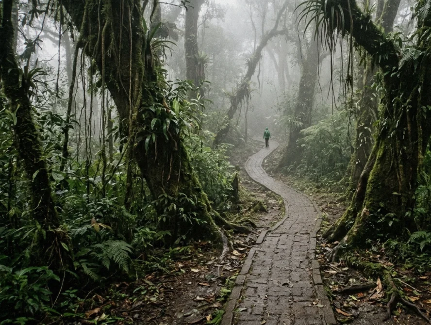
The mist you walk through is low cloud touching the vegetation. It is not always rain, but it wets you almost as effectively, and it is the reason the forest holds more than 3,000 species of vascular plants, over 750 tree species and 450+ orchid species on the official count. The fog banks can also erase the view.
On a cloudy morning the long lookouts on the high trails may show nothing but white, while ten minutes later the cloud can lift enough to see the Pacific and Caribbean watersheds from the Continental Divide Trail. Wildlife viewing follows the same pattern, since a guide with a spotting scope works best when visibility allows one. The forest itself, from bromeliads to moss hung on every branch, looks its best in exactly the conditions that hide the scenery, so treat the mist as part of the product rather than a defect.
Sources: Monteverde Cloud Forest Preserve, Visit Costa Rica, Wikipedia
Monteverde Weather Month by Month
The table below is the honest core of this page: ten years of daily readings averaged by month for the grid point over Monteverde.
Temperatures and rain for all twelve months
The figures below come from Open-Meteo historical weather data (ERA5), 2016-2025 averages, for the grid point over Monteverde at 1,411 m model elevation. High and low are average daily temperatures, rain is the monthly total in millimeters, and wet days count days with 1 mm of rain or more. The walking verdict reads those numbers against what the reserves actually offer, including timed entry slots at the Monteverde Preserve where arriving late can cost you your place.
Two patterns stand out. First, temperature barely moves: the average high swings between 19.9°C and 22.8°C all year, a range of less than 3°C. Second, rainfall moves enormously, from 52 mm in March to 506 mm in October. That contrast, not temperature, is what should pick your travel month.
| Month | High / low | Rain | Wet days | Walking verdict |
|---|---|---|---|---|
| January | 20°C / 15°C (68°F / 59°F) | 121 mm | 18.5 | Drying out after December, still green, decent odds |
| February | 21°C / 15°C (70°F / 59°F) | 62 mm | 13.8 | Driest months begin, strong choice for a walk |
| March | 22°C / 15°C (72°F / 59°F) | 52 mm | 13.9 | Driest month in the record, book early |
| April | 23°C / 16°C (73°F / 60°F) | 72 mm | 17.1 | Still fairly dry, warmest highs of the year |
| May | 23°C / 17°C (73°F / 62°F) | 280 mm | 24.5 | Rains arrive properly, forest at its greenest |
| June | 22°C / 17°C (71°F / 62°F) | 314 mm | 28.0 | Nearly every day sees some rain |
| July | 21°C / 17°C (71°F / 62°F) | 241 mm | 27.4 | A slightly lighter wet month, still very damp |
| August | 22°C / 16°C (71°F / 62°F) | 259 mm | 26.4 | Wet and humid, rain gear essential |
| September | 22°C / 16°C (72°F / 61°F) | 297 mm | 27.0 | Deep green season, few crowds |
| October | 21°C / 16°C (70°F / 61°F) | 506 mm | 29.1 | Wettest month by far, expect soaked trails |
| November | 21°C / 16°C (69°F / 61°F) | 320 mm | 25.6 | Rain easing but totals still high |
| December | 20°C / 15°C (68°F / 60°F) | 151 mm | 21.5 | Turning drier, windy, cooler highs |
How to read the wet days column
Wet days matter more than totals for planning. Even in March, the driest month, 13.9 days out of 30 averaged 1 mm of rain or more, so roughly every second day sees some rain. In October, 29.1 wet days means essentially the whole month is wet.
What the table cannot show is the rhythm of a wet day here: rain often comes in spells rather than falling for eight hours, and mornings are frequently calmer than afternoons. That is why the reserve runs its guided Natural History Walk from 7:30 a.m. to 1:00 p.m. and keeps the general Cloud Forest Walk open from 7:30 a.m. to 4:00 p.m., with the Night Walk running 6:00 p.m. to 6:30 p.m. starts after dark. Early starts buy you the best weather window of the day, which is a fair trade for an alarm clock on holiday.
Monteverde Weather on Video
What a wet afternoon in the reserve looks like, and why the rain jacket matters. Third-party video by Nate Perlow. We did not shoot it and have no relationship with the creator.
Dry Season, Green Season and the Windy Months
Costa Rica talks about a dry season and a green season. In Monteverde neither is absolute, and wind adds a third season the brochures skip.
The dry season, roughly February to April
The data shows a real dry season but a modest one. February averages 62 mm and March 52 mm, against 280 mm in May. Even then, 13.8 and 13.9 wet days a month means rain is never absent, only less frequent.
What the dry season buys you is drier trail surfaces, more views from the high lookouts, and better odds of seeing wildlife that moves in clearer air. Quetzal breeding season runs from mid-February through June or July per the tourism board, which overlaps the driest months, so a February to April visit combines the two best odds the mountain offers. The hanging-bridge parks reward dry weather most, because long bridges like Selvatura's 157-meter span are about the view as much as the walk.
The green season, May to November
From May the numbers step up sharply: 280, 314, 241, 259, 297 mm, then 506 mm in October. If you ask whether it rains a lot in Monteverde, the honest answer is that for about half the year it does. The upside is real.
The forest is at maximum fullness, orchids and epiphytes are in their element, visitor numbers are lower, and the rain often falls in bursts with dry hours between. Trails are muddy and leeches and insects are more active, so waterproof footwear stops being optional. Some visitors deliberately choose September or October for the emptiest trails, but they should know October averages rain on 29 days out of 31 and plan short, early walks rather than all-day hikes.
The windy months
Costa Rica's meteorological institute publishes no quotable month-by-month wind figures for the Monteverde highlands, so no hard numbers are stated here. What the record does show is that December and January carry the coolest average highs of the year, 19.9°C and 20.2°C, alongside totals of 151 mm and 121 mm that sit between the dry and wet seasons. Those months coincide with the dry-season trade winds that the region is known for among local guides, and a strong wind on the Continental Divide makes a 15°C day feel far colder, especially on exposed bridge decks.
The practical advice is simple: if you travel in December, January or February, bring a windproof layer as well as rain gear, and save the highest lookouts for the calmer middle of the day.
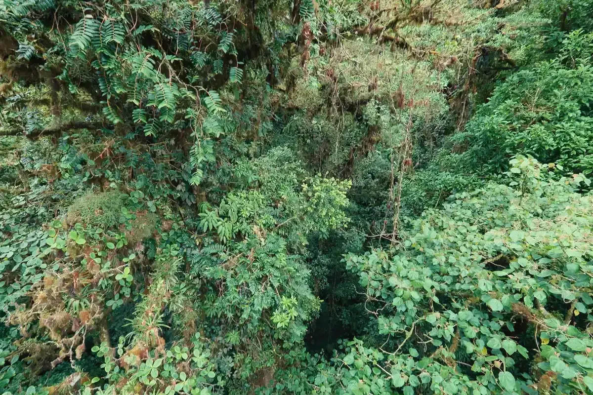
Cloud forest canopy in Monteverde, seen from the Sky Adventures suspension bridges. Photo: Cephas, CC BY-SA 4.0, via Wikimedia Commons
What the Weather Means for a Cloud Forest Walk
Weather is not background to a Monteverde walk. It decides what you see, when you should start, and whether the bridges give you a view at all.
Morning versus afternoon
The single most useful scheduling rule in Monteverde is to walk in the morning. Cloud builds through the day as the sun heats the slopes, so visibility is generally best before midday and the reserve's own guided Natural History Walk runs 7:30 a.m. to about 1:00 p.m. for that reason. Early starts also catch wildlife at its most active, since birds such as the quetzal and three-wattled bellbird feed in the first hours of light.
The small-group Preserve walk runs about 2.5 hours and is capped at 6 participants, which fits neatly inside that morning window. Afternoon walks are not wasted, particularly in the dry season, but expect thicker mist on the ridge and softer light in the forest. If your only free slot is the afternoon, choose a lower trail such as the 1.4 km Essence Trail to the Cuecha Cascade rather than a climb to the Divide.
Visibility on the bridges
Hanging bridges put you at canopy height, which makes them the most weather-sensitive walk in the area. In cloud, a bridge is a wet, breezy platform in white space, in a clear window it shows treetops, birds and sometimes volcanoes. Selvatura's bridge trail runs nearly 3 km with 8 bridges open 7:00 a.m. to 4:00 p.m. every day of the year, so you can time a bridge walk to a clear morning in any month.
October is the riskiest choice, with 506 mm of rain and 29.1 wet days, while February and March give the best odds of actually seeing something from the deck. The Monteverde Reserve's own hanging bridge sits on the 2.8 km Heart of the Forest Trail, about 1.5 hours at an easy to moderate pace, and that one is worth walking even in mist because the wild avocado trees that feed quetzals and bellbirds are the attraction, not the horizon. The guided hanging-bridges tour at Treetopia Park runs 2 hours and bills its $55 park entrance separately, so check the total before you book.
Rain, slots and refunds
Weather also interacts with how the reserve now operates. The Monteverde Preserve runs timed entry slots, parking sits at a Visitor Center 1 mile (1.5 km) below the gate, and a complimentary shuttle departs exactly at your reserved time. You must arrive 15 minutes before your slot, and late arrivals may not be accommodated.
In heavy rain, when the road up slows and the shuttle queue grows, that buffer matters. On the money side, the Preserve's cancellation policy gives a 100% refund for cancellations at least 48 hours ahead, and if weather or safety conditions force a cancellation the reserve notifies you to reschedule or refunds in full. That is a sensible reason to book anything in the green season with free cancellation, which every listing in the Monteverde tour comparison carries at 24 hours or better.
What to Wear and Pack for Monteverde Weather
Dress for a cool, wet, 1,400-meter mountain, not for the beach an hour below. The packing list is short and the same in every month.
Clothing
Average lows never drop below 14.9°C and average highs never exceed 22.8°C, so the temperature itself is easy. The problem is damp and wind, which strip heat fast at altitude. Wear a quick-drying base layer, a long-sleeved shirt against insects, and a proper rain jacket rather than a poncho in wind.
Long, quick-dry trousers beat shorts on muddy trails. Footwear is the item people get wrong most often: closed-toe shoes with real grip, ideally waterproof hiking shoes or boots, because trails in the green season are mud for hours. Add a light fleece or warm layer for early starts and a windproof outer for December through February.
Guides on the Monteverde Reserve walks also ask for biodegradable mosquito repellent and closed-toe shoes specifically, so the dress code is enforced, not suggested.
Everything else in the day pack
Beyond clothing, five items earn their space. A dry bag or ziplock for your phone and passport, since rain finds every seam. A small daypack with a rain cover.
A reusable water bottle, which the Santa Elena listings ask for directly. Binoculars if you have them, because a guide with a spotting scope will find a bird and then hand you the view, and your own binoculars fill the gaps. And a passport copy, which the Preserve walk listings require for entry tickets.
Night walkers should add a warm layer, since temperatures fall quickly after dark from lows around 15 to 17°C (59 to 62°F), and the Kinkajou night walk runs about 1.5 hours after pickup from 110 local lodgings, so you are outdoors well past sundown. Leave the umbrella at the hotel, it is useless in wind on an exposed bridge and awkward on a narrow trail.
Weather Do's and Don'ts
A short set of rules that follow directly from the data above.
Do
- Do book morning walks, because cloud builds through the day and the reserve's own guided walk runs 7:30 a.m. to 1:00 p.m. for that reason.
- Do arrive 15 minutes before your timed slot at the Monteverde Preserve, because the shuttle leaves exactly on time and late arrivals may not be accommodated, and rain makes the road slower.
- Do pack a rain jacket in every month, because even the driest month in the record averaged 13.9 wet days.
- Do visit from February to April if you want the driest trails and the best odds of clear views, which also overlaps quetzal breeding season from mid-February.
- Do bring a windproof layer for December through February, when average highs are the coolest of the year at about 20°C (68°F).
Don't
- Don't plan an October trip expecting dry weather, because the month averages 506 mm of rain across 29.1 wet days.
- Don't rely on a forecast made weeks ahead, because mountain microclimates shift fast and the same day can hold sun, fog and a downpour.
- Don't skip the forest if it rains, because the mist is what feeds the 450+ orchid species and the mossiest sections of trail, and rain is often a burst rather than a full day.
- Don't wear shorts and sneakers because the coast was hot, since lows sit near 15°C (59°F) and green-season trails are mud.
Monteverde Weather Questions
Does it rain a lot in Monteverde?
Yes, about 3,000 mm (118 in) a year on average. The ten-year record shows monthly totals from 52 mm in March to 506 mm in October, and even the driest months average around 14 wet days. Rain is part of what makes the cloud forest, so pack for it and plan early walks, as the advice on a guided cloud forest walk suggests.
Is it cold in the Monteverde Cloud Forest?
Not cold, but cool. Average highs run 20 to 23°C (68 to 73°F) and lows 15 to 17°C (59 to 62°F) all year, with a mean annual temperature of 18°C (64°F). Wind and mist make it feel colder on the ridge, so bring layers, and check what the Monteverde Reserve walks ask you to wear.
What is the climate like in Monteverde, Costa Rica?
A cool, wet mountain climate at roughly 1,400 m (4,600 ft), with barely 3°C of difference between the warmest and coolest monthly highs, and rainfall that swings from 52 mm to 506 mm a month. Over 90% humidity is recorded year-round at the nearby Santa Elena reserve. The month-by-month table on this page has every figure.
What is the best time to visit Monteverde?
For weather alone, February to April is the best window, with the lowest monthly rainfall in the record at 62 mm and 52 mm, the year's warmest highs at 22.8°C (73°F) in April, and quetzal breeding season from mid-February onward. To pick a walk for that window, compare the guided Monteverde cloud forest tours by price, reserve and group size.
When is the Monteverde rainy season?
The green season runs from about May to November. The data shows the step change clearly: April averages 72 mm, May 280 mm, and October peaks at 506 mm across 29.1 wet days. If you travel then, book a walk with free cancellation, such as this small-group Preserve walk, and start early in the day.
Is Monteverde windier at certain times of year?
The national meteorological institute publishes no quotable monthly wind figures for the Monteverde highlands, so no number is stated here. What is known from the record is that December and January bring the coolest average highs, about 20°C (68°F), which locals pair with the dry-season trade winds on the Continental Divide. A windproof layer is the practical answer, and the packing list on this page covers it.
What should I wear for a cloud forest walk?
Wear a quick-dry base layer, long trousers, a real rain jacket, and waterproof closed-toe shoes with grip, plus a fleece for early starts and a windproof layer in the windy months. Guides on the Monteverde Reserve walk also require closed-toe shoes and biodegradable mosquito repellent, so pack both.